Cartographing Urban Ecosystems
The project Cartographing Urban Ecosystems (COE) is a global study to spatially understand the effects of architecture in conjunction with human behavior on urban and natural ecosystems.
Wienfluss
The collected data on the Wienfluss, shown on various graphs with descriptions
Video
as shown at the Klimabiennale 2024 in Vienna
MAP - Wienfluss
concept of a mobile cartographic display
interactive map of the collected data at the Wienfluss, shown on official cartographic data, provided by the city of Vienna.
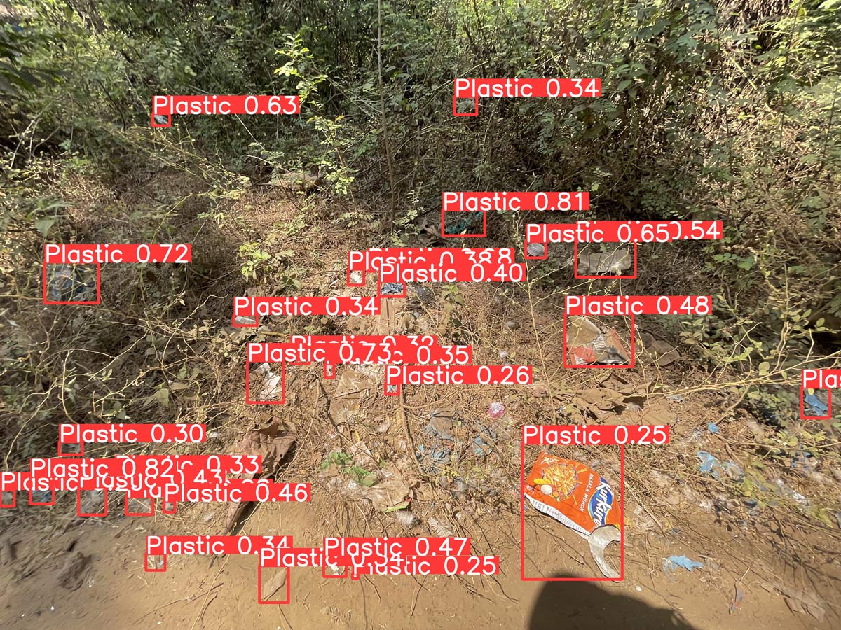
Palolem
The collected data in an informal settelment in India, shown on various graphs with descriptions
Paper
Project Description/2024
.jpg)